Daha Büyük Görüntüle
Çankırı
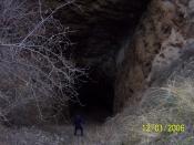
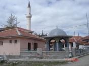
Interior view of the central dome of Çankırı Great Mosque
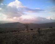
Location of Çankırı within Turkey.
Çankırı is located in Turkey
Çankırı
Location of Çankırı within Turkey.
Coordinates: 40°36′N 33°37′ECoordinates: 40°36′N 33°37′E
Country Turkey
Region Central Anatolia
Province Çankırı
Government
• Mayor İrfan Dinç (AKP).
Population (2010)
• Urban 69 631
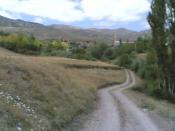
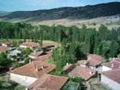
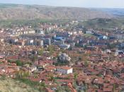
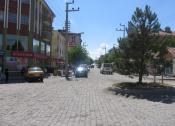
Çankırı is capital city of Çankırı Province, in Turkey, about 140 km (87 mi) northeast of Ankara. It is situated in a rich well-watered valley, at about 800 m (2500 ft) in elevation.
History
It was known in antiquity as Gangra, then Germanicopolis (Greek: Γερμανικόπολις) for a period, although Ptolemy calls it Germanopolis (Greek: Γερμανόπολις),[1] then Changra, Kandari, or Kanghari.
The settlement witnessed the hegemony of many cultures and races, such as Hittites, Persians, Greeks, Parthians, Pontus, Galatians, Romans and Byzantines, up to Seljuks and finally the Ottoman Turks, and the traces from its long past stand all over the area.
Gangra, the capital of the Paphlagonian kingdom of Deiotarus Philadelphus, son of Castor[disambiguation needed], was absorbed into the Roman province of Galatia on his death in 65 BC. The earlier town, the name of which signified she-goat, was built on the hill behind the modern city, on which are the ruins of a late fortress; while the Roman city occupied the site of the modern. It was named Germanicopolis, after Germanicus or possibly the emperor Claudius, until the time of Caracalla.
In Christian times Gangra was the metropolitan see of Paphlagonia. Hypatios, considered a saint in the Orthodox tradition, was bishop there. He was killed by Arianians on return from the Council of Nicaea (325) in which he took part.
In the 4th century the town was the scene of an important ecclesiastical synod, the Synod of Gangra. Conjectures as to the date of this synod vary from 341 to 376. All that can be affirmed with certainty is that it was held about the middle of the 4th century. The synodal letter states that twenty-one bishops assembled to take action concerning Eustathius of Sebaste[2] and his followers, who condemned marriage, disparaged the offices of the church, held conventicles of their own, wore a peculiar dress, denounced riches, and affected especial sanctity. The synod condemned the Eustathian practices, declaring however, with remarkable moderation, that it was not virginity that was condemned, but the dishonouring of marriage; not poverty, but the disparagement of honest and benevolent wealth; not asceticism, but spiritual pride; not individual piety, but dishonouring the house of God. The twenty canons of Gangra were declared ecumenical by the Council of Chalcedon, 451.
Agriculture
Various produce like wheat, corn, beans, apple etc. are grown in the farms, and fields that are rich of water.
Industry
Most of the industry is located near the city center and Korgun. Other towns that are in the industrial map of the city are Şabanözü, Çerkeş, Ilgaz, Kurşunlu, and Yapraklı.
Source |